Lockdown has encouraged many of us to get out and explore our local area. I started with areas that I know well – Temple Newsam Park and St Aidan’s RSPB Reserve.
Then my wandering extended. I noticed unfamiliar paths and followed them. One such trip took me to the Lines Way.
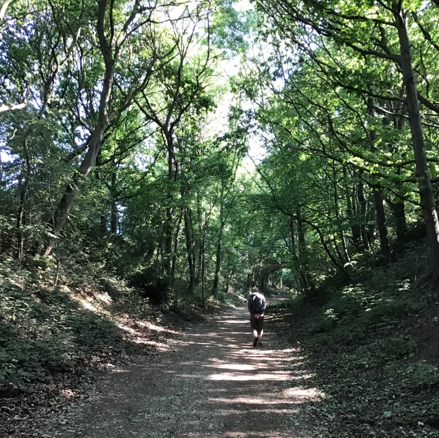
My first line of travel took me from St Aidans to Wood End and along the Lines Way to Allerton Bywater. From there I could weave towards the River Aire and follow it back towards St Aidans. I have now explored all four miles of the disused railway that forms the Lines Way. The route is managed by the Yorkshire Wildlife Trust and is a rich habitat for plants, birds and small mammals. It passess a number of other nature reserves – Townclose Hills, Hollinhurst Wood, Owl Wood and Letchmire Pastures. The Lines Way has created a natural corridor for wildlife and people, from one green space to another.
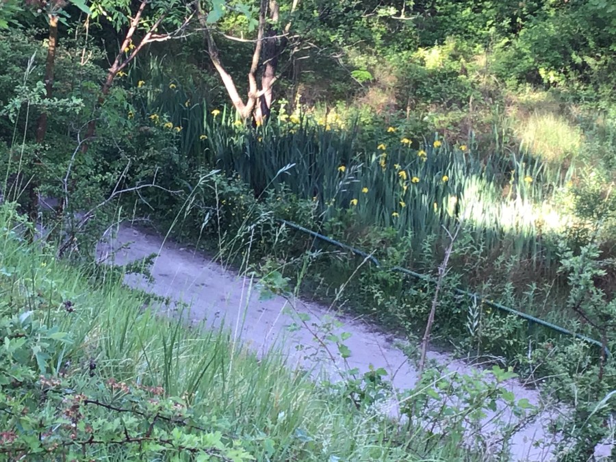
The branch line that linked Garforth-Castleford closed over fifty years ago. At times, it sank down, running through cuttings. These sections are now hidden havens. Shade-loving plants edge the line, sometimes watered by natural springs. A favourite spot is near the entrance to Townclose Hills in Kippax, where small, boggy pools line the path and play host to frogs, yellow iris and common spotted orchids. At other points, embankments raise the track up above the surrounding land, providing views of farmland, gardens or natural conservation areas. In some places, the path skirts residential areas but still offers rich pickings for songbirds. Goldfinch, blue tit, sparrows, blackbirds and song thrush dart from garden to woodland edge and back again.
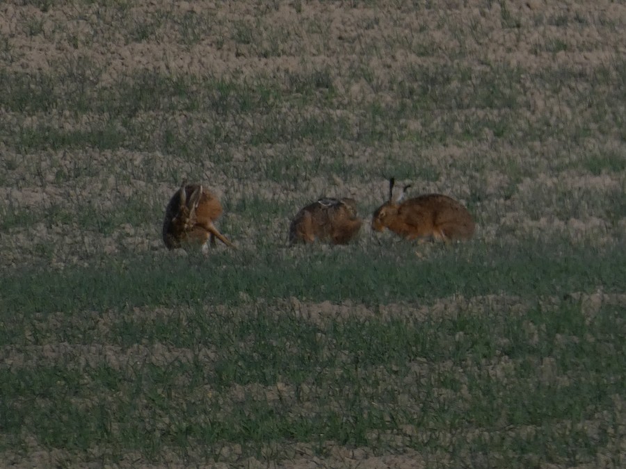
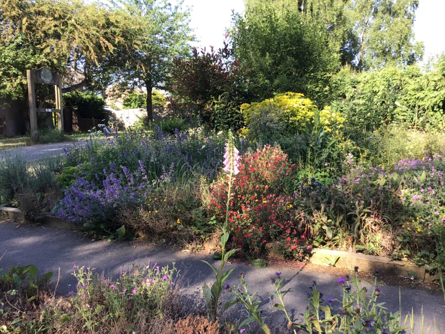
The linear route is fringed with a variety of trees and wildflowers. In some parts the line is edged by fields. Go early or late and you will often see hares and rabbits. One evening I was privileged to see a barn owl begin its evening hunt, sweeping silently from woods across open farmland. Other areas adjoin ponds and marshland, where herons, ducks and cormorants can be spotted.
Humans follow the line: cyclists, walkers, joggers and the occasional horse rider. It is level enough for wheelchair and pushchair access but long enough for a good work out. The linear track connects areas of human habitation: Garforth, Kippax, Great Preston, Wood End and Allerton Bywater. My early morning walks took me past pedestrians clasping a morning paper, lunch time brought bags of groceries and in the early evening I might get a whiff of fish and chips or curry.
Following the line replaced driving or public transport for many. As lockdown eases, I hope people will remember that you do not always need to drive to fetch provisions. In the early days of lockdown many people were not driving at all, preferring to combine exercise and shopping for essentials. For people who normally use public transport, being able to walk or cycle along paths such as the Lines Way was a godsend.
The line from one settlement to another reminded me of the current Slow Ways project. This aims to create a network of walking routes that connect all of Great Britain’s towns and cities, as well as linking hamlets and villages. During lockdown, across the country, volunteers have been collaborating to produce a first draft of the network. Already 7,000 routes that stretch for over 100,000 km have been gathered. I missed the initial call for volunteers, but later in the year the project will be looking for people to test and feedback on the suggested routes. I am looking forward to seeing how the Lines Way and other local paths have been incorporated into a network to encourage people power rather than petrol power. It is intended that the entire Slow Ways network will be published online and made freely available via Ordnance Survey.
As lockdown progressed I was able to track the change of the season on the line. Normally, we note the big changes. When trees become covered in leaves in spring, when they change colour in autumn and then transform to the bare branches of winter. This year I noticed the subtler changes; the first buds, which leaves appeared first, the arrival of blossom. I noticed waves of colour.
First white, as hawthorn blossoms cascaded downwards, bramble flowers appeared at waist height and cow parsley rose from the ground. Then the palette switched to the yellow of iris, gorse and buttercups, the egg yolk centres and white jagged leaves of the oxeye daisies uniting the two phases.
Human interaction on the line also changed. People began making the Lines Way their own. On the widest stretch at Wood End, where a variety of paths intersect, trees are now decorated with pom poms. Previously individuals, or couples, inhabited the space. Now, whole families can be found cycling or strolling.
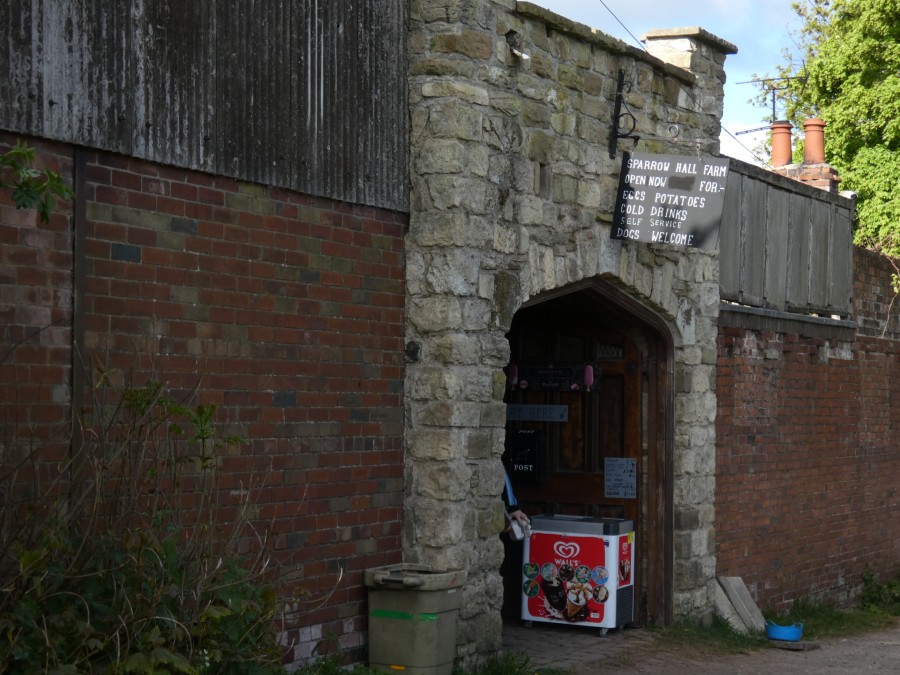
Benches near Kippax are a place to pause. Initially used by people who needed a rest on the way to, or from, their destination, they later became places for reflection, or family picnics. A handmade sign by a picnic site directs you to Swallow Hall Farm, where their small shop can provide you with ice cream and chilled drinks. I enjoyed sitting here on a hot afternoon, serenaded by the farm’s peacocks, whilst cooling with an ice lolly.
Lines take you from place to place but also form their own distinct environment. The ecologist Hugh Warwick, in his book Linescapes, reflects upon how our human lines – hedges, road edges, dykes, railways and canals, can, when managed sensitively, become routes for nature. The Lines Way demonstrates how we can use human constructions to both develop natural habitats and link them together. The land given over to housing in Leeds expands each year, but there are still lots of open spaces that need to remain connected.
Walking the Lines Way is all about making connections. I encourage you to use it to connect with places, people and nature.
All photographs by Debbie Rolls. Feature photograph shows the entrance to The Lines at Allerton Bywater.